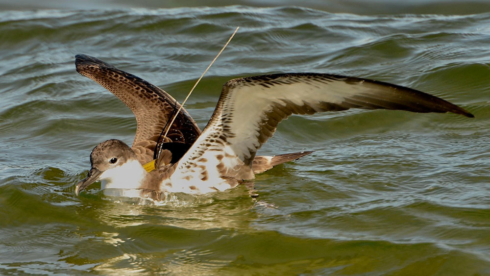
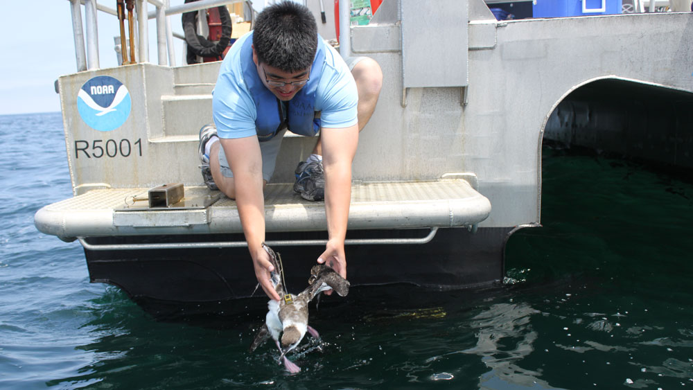
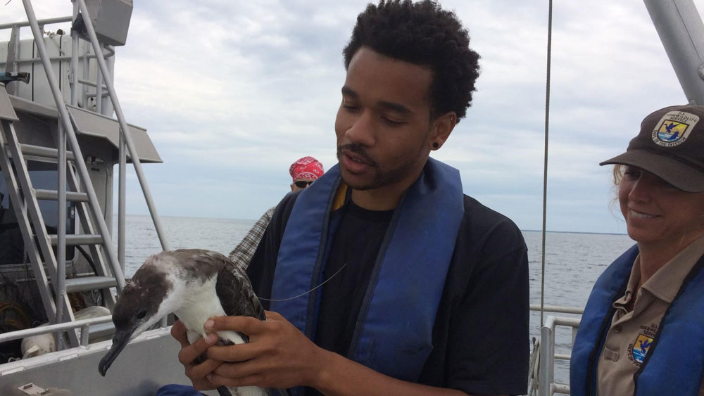
Since 2013, researchers at NOAA's Stellwagen Bank National Marine Sanctuary have been using satellite technology to study the movements, life cycle, and feeding and foraging habits of great shearwater seabirds in the Gulf of Maine ecosystem. After attaching transmitters to the backs of the birds, the scientists then follow their movements from the signals sent out by the tags.
This year, 15 birds will be fitted with the transmitters, which are placed on their backs and attached with degradable thread. Small and lightweight, the tags do not interfere with flight, and are equipped with mini solar panels that provide the technology with long life. In recent years, several tags have survived well into the winter, giving the science team the bonus of being able to follow the birds' migratory paths into the South Atlantic.
Why follow the birds' movements? Sanctuary scientists believe that seabirds -- especially great shearwaters, one of the most common seabirds in the sanctuary -- are excellent indicators of ecosystem health, and may provide insights into impacts of climate change. Alterations in water temperature, currents, or other factors can seriously impact the seabirds' food supply. These birds prey primarily on sand lance, a small pencil-like schooling fish, which is an important food for many large predators in the Gulf of Maine, including whales, dolphins, bluefin tuna, and other important commercial and recreational species.
Follow the Birds: Periodically, the science team will update the shearwaters' movements with tracking maps, weekly summaries of bird activity, and other timely information. Check back on a regular basis. You can also follow shearwater tracking and related science at our associated Twitter: @TrackSeabirds and the sanctuary's social media platforms on Twitter (@NOAASBNMS) and Facebook.
For Educators: The sanctuary offers two maps for tracking shearwater movements. One map is for the Gulf of Maine and the second is of the Atlantic Ocean (North and South Basins). The coated surface on the paper allows for the placement and removal of sticky dots for repeated use. The sanctuary education team has prepared a generic tracking activity and other background materials. Email stellwagen@noaa.gov for more information.
The Team: Dr. David Wiley, research ecologist for the sanctuary, leads the shearwater tagging project. Additional sanctuary staff include Michael Thompson, sanctuary geographer and GIS specialist, and Dr. Tammy Silva, postdoctoral researcher, along with Kevin Powers, a volunteer with the Stellwagen Sanctuary Seabird Stewards program and seabird expert. The research team includes Linda Welch, U.S. Fish and Wildlife Service seabird specialists at the Maine Coastal Islands National Wildlife Refuge, Dr. Les Kaufman, Boston University, Dr. Kent Hatch, Long Island University, Dr. Anna Robuck, University of Rhode Island, and Dr. Robert Ronconi Environment and Climate Change Canada. Funds for the project have been provided by the Volgenau Foundation, Bureau of Ocean Energy Management, the Davis Foundation, and the Mudge Foundation.
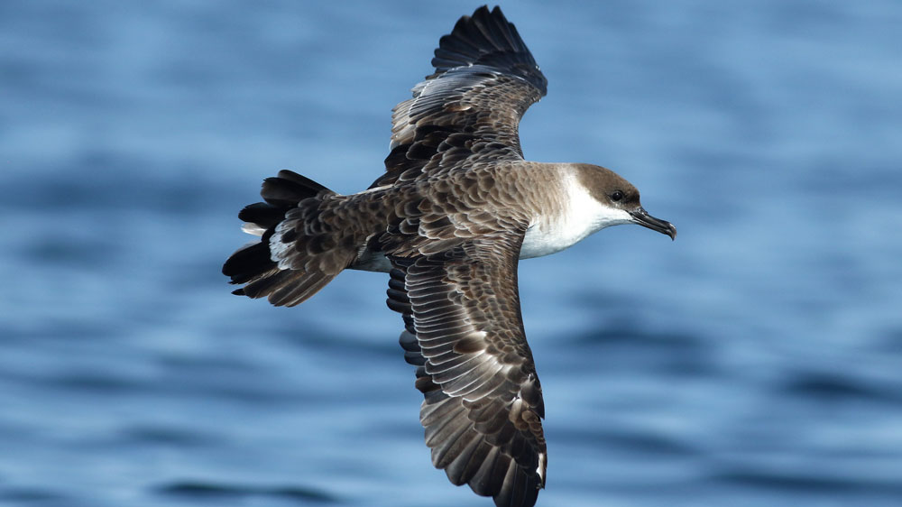
The great shearwater (Ardenna gravis) is a gull-like seabird that is dark above and white below, with a dark cap on its head and dark coloring on the trailing part of its tail. It has a white band around its neck, a black bill, and a white rump patch. It is one of the larger birds in the seabird family Procellariidae. Three other shearwater species also visit the sanctuary – the similarly sized all-dark sooty shearwater, the larger Cory's shearwater with a light brown head without the white neck band, and a smaller Manx shearwater whose dark coloring extends from its head directly to the back.
The great shearwater feeds on small schooling fish in the sanctuary, often in large groups that include various gull species and other shearwaters. These birds are often seen near feeding humpback whales, targeting fish that evaded the larger predator, and can also be seen following fishing boats, eating the discarded offal and scraps.
Great shearwaters will glide over the wave tops with stiff outstretched wings. To catch fish, they undertake short plunges from the air, dive from the surface and swim underwater, or pick items from the surface. Once sitting on the ocean's surface, the birds need to take a running start to get airborne. They breed during our winter season on the Tristan da Cunha Islands (Tristan da Cunha, Nightingale Island, Inaccessible Island, and Gough Island) in the southern part of the South Atlantic Ocean in large dense colonies where the female lays one white egg on open grass or in a small burrow. Northern feeding grounds range from Florida to the Labrador Sea (south of Greenland).
Their migratory route is a "great circle" or, more figuratively, a "great eight." From their breeding grounds on the Tristan da Cunha Islands (considered the most remote island on the planet) or the Patagonian Shelf off South America for the non-breeders, the shearwaters fly north to their feeding grounds, arriving in the sanctuary and Gulf of Maine as early as April. At the end of the summer, many birds fly to the Eastern Atlantic, to areas off the Azores and west coast of North Africa. The next stage takes the birds westward to waters off Brazil and more southern feeding areas off Uruguay and Argentina. Breeding birds now shift east to the Tristan da Cunha Islands while non-breeders remain close to South America.
Sanctuary scientists want to learn more about how seabirds react to changes in their primary food source and what factors cause changes in forage fish abundance. Signals from the tags have allowed scientists to plot bird movements. They can then relate the movements to oceanographic features such as water temperature, bathymetry, chlorophyll concentration, ocean fronts and other factors that might result in increased productivity or that concentrate prey. This year, two tagging missions will attempt to tag sets of mature and immature birds to study differences in feeding patterns and migration routes.
Check back for the latest tracking maps showing the cumulative paths of all 15 tagged great shearwaters, plus analyses of their movements, and data sets of daily locations!